

Monuments Move - Landowners Lose:
A Surveyor’s Dirty Little Secret

|


 Share
This Article
Share
This Article
By Will Goode
Investigative ReporterGrangeville, ID - If you think being imprisoned when you are innocent is bad news, how would it feel to be dispossessed of your property when it has been in your family for 40, 50 or 100 years? The trick is for one adjoining neighbor to hire a new-breed-of-surveyor who bends the law (being protected from prosecution by the surveying profession) and makes up new boundaries based on his own rules because it’s good for his business; in the end though, he takes away the vested property rights of all landowners. In reality, this is a deceptive trade practice and a violation of the Consumer Protection and anti-fraud laws of all 50 states according to surveyor and lawyer, Jeffery N. Lucas.
By the way, the Attorneys General (AG) of the several states where this is happening simply will not prosecute because it involves crimes committed by members of a so-called “regulated profession” deemed ‘sacred-cows’ and exempt from enforcement action. It is not that the AG has no power to prosecute them; rather, it is that the crony system among surveyors and engineers is so powerful, that with actively practicing members of the profession sitting on the boards that are supposed to regulate surveyors, they cannot see that their fellow professionals are doing anything wrong. They are literally blinded by their own so-called “professionalism.”
Judges today have even bought into this concept with the attitude that “the professionals know best” and certainly, judges, don’t want to be seen as bucking the system. None of this bodes well for the landowners who are the consumers of surveyor services.
George Washington, Thomas Jefferson, Abraham Lincoln as well as Lewis and Clark, all had this one thing in common, they were surveyors. You see, ‘In the Beginning…’ there was vacant land and people wanted to own a portion of it to build their homes on; hence, the American Dream. Whether it was the east coast property acquisitions from the Native Americans or the Louisiana Purchase from the French or Mexican Land Grants, the pattern and practice was the same: Define the boundaries and then make it available for settlement by the public. Some settled as homesteaders, staking their claim and complying with certain minimum requirements, while others outright purchased their property. Either way, at the end of the day, the expectation was the same: all landowners knew where their boundaries were located because of monuments originally set by the great surveyors of the past.
For generations, the landowners of America have relied upon the original work performed by surveyors who established points of origin by placing monuments (such as a notched stone or markings on a witness tree or other objects of at least semi-permanent quality) and then from these original monuments, created the “Point of Beginning” for each parcel of land.
Along the eastern seaboard of the USA, original monuments were established first by the Pilgrims and early settlers, then eventually by surveyors, such as our first President. In the west, the General Land Office of the United States laid out the original monuments based on the Rectangular System of Surveying. However they were created, all current-day owners expect to look back upon the historical establishment of original monuments from which they can trace the perimeter of their property.
Today, there simply is not as much surveying work as in the boom days before the real estate bubble burst in 2008. Many surveyors need work because most of the available land that easily could be subdivided, has been developed and that which is left are tracts of land containing larger acreages, either owned by the government or by private interests, for which there is: 1) no authority to develop (public lands); 2) no current demand for subdivision; or 3) no financial backing available for development.
Left without ‘rudder or sail,’ the proverbial ‘mariners of surveying’ must find a way to support themselves and their families. For many of them, they have no other occupation, thus, the choice is “Survey or Starve;” which dictates that the surveyor must ‘do something’ to create business for himself.
Within the industry of surveying, there are those who consider surveyors to be “stewards of the nation’s property boundaries.” A surveyor has two choices, if he can state that he is unable to find an original monument then that is his excuse to postulate where such a monument should exist by using a fraudulent engineering computation, also known as a “Math Stakeout” or he can perform a legitimate “Retracement Survey.” In the Retracement Survey, the surveyor must find the location of the original monuments that provide “control” for the area, some of which may be more than a mile away. If the nearest original monument is missing, the surveyor can reach out to the next nearest original monument for control or utilize existing structures to validate the retracement. A surveyor conducting a Retracement Survey is legally bound to follow the lines from original monuments, retracing the bearings and distances used by the original surveyors to reestablish the original boundaries or to locate the place where missing monuments were located before they disappeared; then, and only then, can he opine as to the particular application to the property of the landowner who hired him.
In a Math Stakeout, the surveyor simply creates by mathematical calculation what he thinks is the right adaptation of the boundary based on engineering principles, but, because he fails to start with the true original monument that originally provided control over the area, that surveyor performing the math computation absolutely cannot locate the original boundaries and will always be in the business of creating new boundary lines. In creating new lines, the surveyor can then sell his stock and trade to the unsuspecting landowner, who, if it involves an increase in his property, is delighted to pay handsomely to add a few acres at the expense of his neighbor and that is just human nature, to want to receive something for nothing.
The reality is that there is not one consumer in 10,000 who understands what surveyors do; which makes them easy prey for surveyors to commit the crime of property theft by fraud. This is worse than not understanding how your local brain surgeon operates. If the unscrupulous surgeon was to lure patients in with promises of improved intelligence and then perform lobotomies, the consumer of his healthcare services and his family would be sorely disappointed and might even sue the doctor. In like manner, the consumer of surveying services can be easily baffled by the surveyor’s technical ‘bull-loney,’ so that he becomes convinced that he owns his neighbor’s driveway or a large chunk of his neighbor’s land; and then the legal battles begin.
To illustrate the severity of this problem: imagine, if you will, that a surveyor from Connecticut has declared that the original monuments defining the boundaries of an adjoining state, say Rhode Island, are “erroneous.” Then the surveyor offers up a solution by mathematically creating new monuments and draws up a new boundary line between the two states and declares that the land within the newly defined area is really the property of Connecticut. Now, let’s say, that the newly defined area involves only a mere three hundred (300) square miles (a trifling amount of land in the big scheme of things, right?). Since the total area of Rhode Island is a paltry 1,241 square miles, that would be roughly a one-fourth or a 25% of the land mass of the entire state of Rhode Island, which by now, our hypothetical surveyor, has claimed for Connecticut. Clever surveyor: after recording this fraudulent survey, it could take years and millions of dollars to correct the problem. Meanwhile, how many people and their lands would be adversely affected?
Hunter EdwardsThe people of Connecticut would be cheering while the folks in Rhode Island might be objecting and do you think a general uproar is likely? Maybe it would go viral on the Internet and even the “dumbed-down Mainstream Media” might report the story. What if Mexico was to do the same thing along the border with the USA gobbling up some of Texas, New Mexico, Arizona and California; in such a case, we might even see a declaration of war. In other words, property owners, especially US citizens are hard wired to defend what they believe is theirs (sometimes to the death) and that too is a part of the human condition. But, the law specifically states that surveyors are not to create disputes among neighboring landowners; so how can this be?
Think about this, if a surveyor who wants to grow his business starts moving original property monuments (or makes them disappear so that he can recreate them) then he can move boundaries between neighbors at will, and it is likely that each landowner will demand his own survey (more business). All of a sudden, instead of a Starving Surveyor, there is plenty of business for all the surveyors and maybe a few engineers as well. Clever surveyors.
According to highly credible professionals I have interviewed, “One of these new-breed-of-surveyors actually refers to himself as the “Wizard” of North Idaho because he has developed a scam that allows him to dance around original monuments with words like “erroneous” and then adjust the location of those original monuments as he has developed a vast book of new business from the landowners who have been suckered into his operation. This surveyor is Hunter Edwards, whose father before him was a surveyor and the two of them figured out a scam that has not yet been unraveled, but it is based on the concept that the original General Land Office survey monuments set in the late 1800s were “erroneous” which they think gives them license to relocate those original monuments at will by applying a Math Stakeout solution rather than performing a retracement survey.”
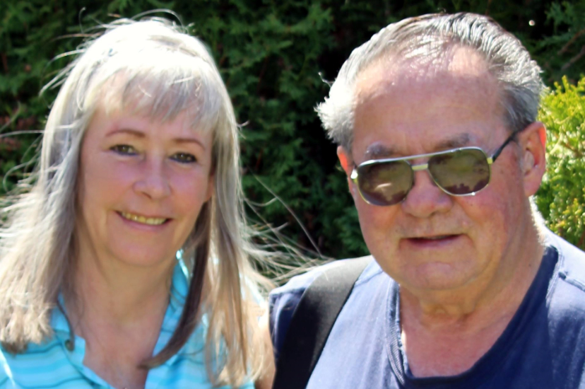
Dorothy and the late Butch WalkerThe professionals continue, “The cost of these shenanigans by the Edwards clan to landowner Dorothy Walker has been the loss of over 40 acres, all done surreptitiously by sneaky little changes in documents recorded at her home of Idaho County. Dorothy has studied the problem and qualifies as the one in 10,000, but she still cannot get responsible survey work from the Edwards clan because they are being protected by the other professionals who also think this Math Stakeout Solution is good for business and refuse to look at the Edwards’ professional ethics violations and the Edwards’ failure to follow established procedure required by Idaho State law; their reaction is simply to ignore it. The Edwards clan of surveyors are also being given a pass by the Idaho Attorney General who refuses to prosecute them because regulation is left up to the professional board composed 100% of practicing surveyors. Has the proverbial fox been left to guard the hen house?”
Well folks, this is exactly what is happening all over America today and it is happening in Idaho and specifically, it has happened in Idaho County, which is one of the most unlikely settings, although the place is bucolic and it is an area that is still filled with big game and a very desirable place to live or have a cabin because it is so remote. Shamefully, there are those in Idaho County who would set false monuments and take your land in a heartbeat and the operative force behind them are the surveyors who subscribe to the improper and illegal process of “proportioning” in corners with a Math solution when the evidence of the position of the original corner is right before their eyes. To be clear, the process of proportioning or the Math Stakeout can never find the original boundary lines or monuments and it is doomed to always be the source of land theft.
With the amount of land development and subdivisions drastically down in America today, the trend has been to create work for surveyors by either removing or relocating the original “permanent” survey monuments that have been relied upon for over a hundred years, and then claiming that such monuments have been “located” by applying the Math Stakeout solution costing some landowners large portions of their property.
This attack on the sovereign rights to property ownership is fostered by the new breed of surveyor mentioned above who believe they can simply state that the original monument, set over a hundred years ago is “erroneous.” A nebulous term that really has no meaning unless placed in context of a multi-faceted and highly detailed analysis; and when applied, the detailed analysis will show where the original monument is actually located. Yet, this term “erroneous” is the basis reportedly used by the Edwards clan and other surveyors of similar persuasion for moving boundary lines hundreds of feet without regard to the retracement of the original monuments.
Understanding why we are ‘where we are at’ is as important as anything. Surveying is complicated to some and mysterious to others, but the effect of losing land can be understood by everyone. Readers with similar issues should contact their state legislators and demand that this problem be investigated in their home state before rights become vested based on the fraudulent surveys developed by Starving Surveyors, who are not quite so hungry any more thanks to all the payments from defrauded landowners.
Will Goode is an investigative reporter for Independent News International, World Report who is willing to tackle difficult issues even though not politically correct. He can be contacted through the Editor, Pat Shannan at www.iniworldreport.com.
Editor’s Note: There is another reason that unethical surveyors record fraudulent surveys and that is because they are paid to knowingly do so. We will address this more as it relates to the Walker case in the near future.
Anyone with information on those involved in the Walker case or fraudulent surveying in general is urged to contact Edward Snook at 541-474-7885 or by email to editor@usobserver.com.
Are you losing your property because of bad surveying? Have you been defrauded? Call us – we just might be able to help you.
Subscribe to the US~Observer News Flash Alerts!

Subscribe
to the US~Observer |
Get
a subscription to US~Observer delivered
right to your mailbox via first-class mail!
Click Here for more information